Products
We provide services in the area of commercial and technical consulting.
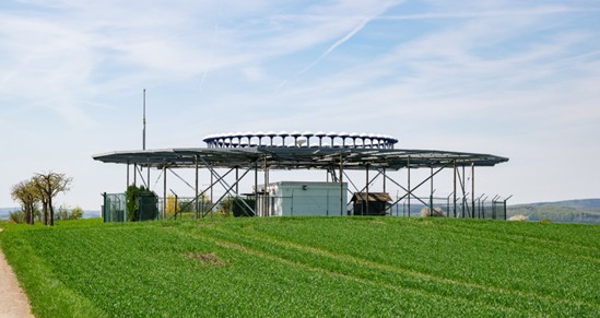
DVOR/DME
We provide specialized services in DVRs.
DVRs are radio navigation devices used to determine the location of an aircraft relative to a point on the ground.
Using VHF radio signals transmitted by the DVR station, the aircraft can locate its installation point on the ground and know its position relative to it.
The maximum coverage of this equipment depends greatly on the altitude of the aircraft and the power of the DVOR station, however it should not exceed 200 nautical miles.
The DVOR system comprises the following subsystems:
• Transmitter unit
• 48-element antenna system
• Counterpoise antenna support structure
• Monitoring antennas
• Cabin to house the system, with A/C, UPS, and batteries
• Remote Control Unit
The DME is a radio navigation device that allows an aircraft's distance from a point on the ground to be determined with precise accuracy.This system is typically used in conjunction with another Radio Aid, namely a DVOR or ILS.
Its implementation allows aircraft pilots to know exactly how far they are from the destination airport or, when en route, from the DME location.
In addition to the transmission unit, the system consists of the corresponding antenna and the RMM Control and Monitoring unit with a PC, monitor, and dedicated software.
The transmission unit is installed in the same cabin as the DVOR or ILS unit, as applicable.

RCSU

AGL
We provide specialized AGL services.
Runway lighting, or AGL (airfield ground lighting), is a set of colored lights that clearly define all aircraft taxiing and parking areas, as well as the runway and landing zone, to aid the transition from instrument flight to visual reference flight during the approach to landing procedure.
The AGL is part of a lighting system that includes the Approach Ramp Indicator (VASIS) and the Precision Approach Trajectory Indicator (PAPI).
There are also Transportable Runway Lighting systems, designed for temporary situations or as an emergency resource.

VCCS
We provide specialized VCCS services.
The VCCS (Voice Communication and Control System) unit is the heart of the ATC system, centralizing various voice communication modes, including radio and voice, and also enabling internal communication methods such as intercom, relay, and conferencing. It also allows connection to the communications recording system for recording and playback of all voice traffic.
Among the features available on the equipment, we highlight the most frequently used:
• Allows voice communications between air traffic controllers in the same Control Tower or with other airport services connected to the system.
• It also allows the following tasks to be performed through dedicated interfaces:
1. Ground-to-Air Communications
2. Ground-to-Ground Communications
3. Intercom
4. Hotlines (Emergency Lines)
5. Emergency (Fire Department, Hospital)
6. PSTN Connections
The equipment is prepared to support VOIP connection requirements according to ICAO standards.
Mode and task selection, as well as communication destinations, are performed via touchscreen monitors located at each controller and supervisory position. The system is also complemented by speakers, microphones, and headsets at each workstation.

RADIO VHF-AM
Ground-to-Air Communications
Radios designed for use in metal cabinets (racks) programmed with Very High Frequency (VHF-AM) designates the range from 30 MHz to 300 MHz.
This is the signal used for 118-132 megahertz transmissions: Airband for air traffic control, AM.
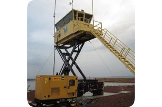
ATC-MOBILE
We design comprehensive mobile air traffic control tower systems.
It's a replica of an air traffic control tower, but designed for two air traffic controllers.
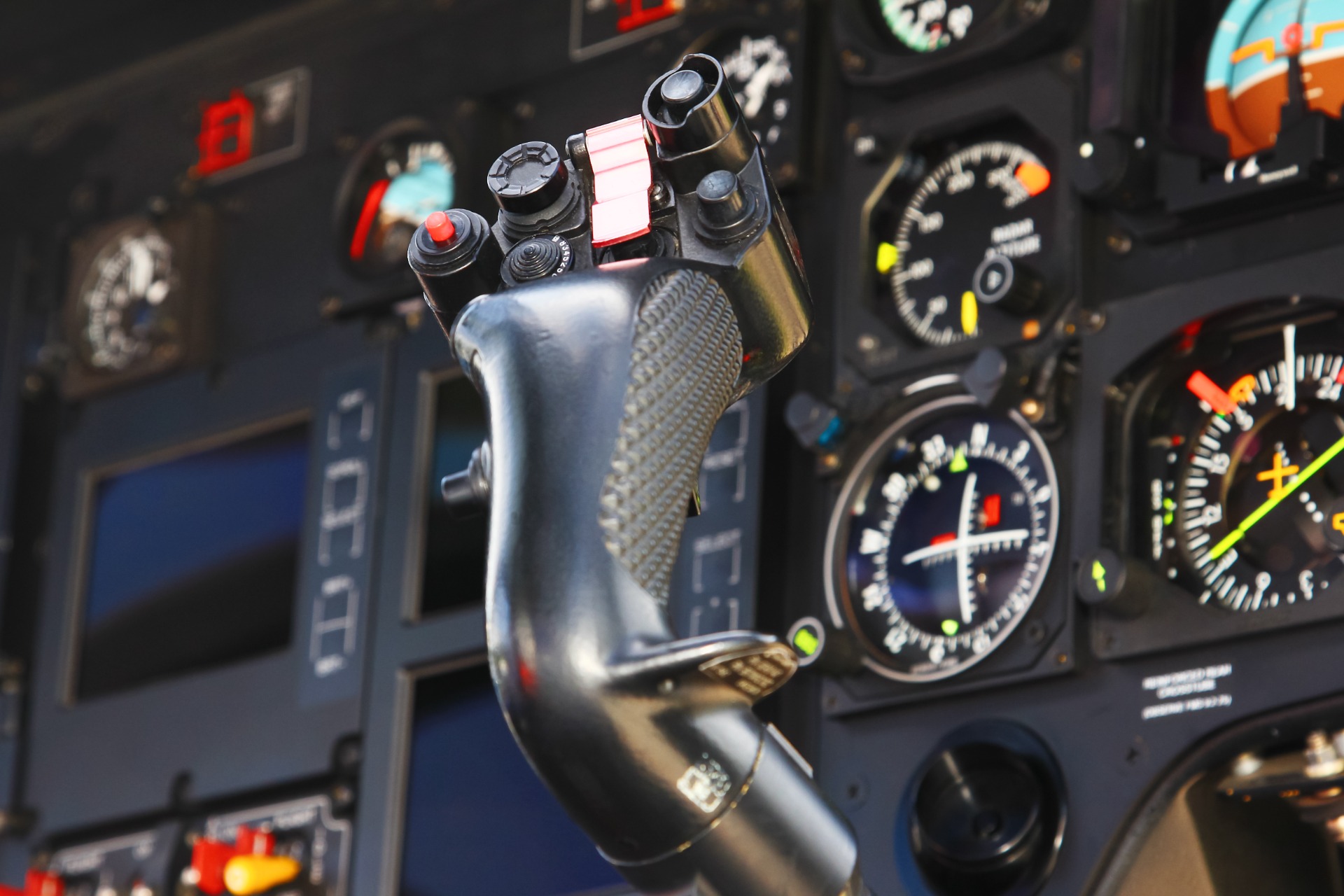
CALIBRATION EQUIPMENT
The onboard inspection and calibration system allows operation of the following air navigation and airport visualization aid systems:
• Instrument Landing System (ILS) up to CAT III
• Marker Beacon Systems (MB)
• Distance Measurement System (DME)
• VHF Omni-Directional Range (VOR) CVOR/DVOR version
• Non-Directional Beacons (NDB)
• Precision Approach Radar (PAR)
• Primary and Secondary Radar (PSR/SSR)
• Visual Navigational Aids (PAPI, VASI, Airfield Lighting)
• GPS/GNSS procedure verifications
• Instrument Flight Procedures
Our certifications are widely accepted by all airport authorities in the southern part of the continent, as well as by international organizations, including:
• International Civil Aviation Organization (ICAO)
• United Kingdom CAP670
• New Zealand Civil Aviation Authority
• Civil Aviation Safety Authority Australia

ILS/DME
We provide specialized ILS services.
The ILS is a radio assist system, essential for aircraft approaching and landing at airports with adverse conditions and poor visibility.
The ILS is classified into categories I, II, and III, depending on the conditions of the airport where it is installed and follows the standards established by the ICAO.
The system consists of two distinct units that complement each other's performance:
• The Localizer, installed at the runway threshold, serves to align aircraft on the runway centerline. The 14-element antenna mounted on a concrete block transmits the alignment signal to the aircraft. The Localizer's chassis is housed in a dedicated cabin, meeting all environmental requirements required by applicable regulations.
• The Glidepath or Glideslope is a device used to align aircraft on the runway slope at an angle predefined by the relevant authorities. It features a system of horizontal M-array antennas installed on a 9-meter-high tower located to the side of the runway, approximately 250 to 400 meters from the threshold.

NDB
We provide specialized NDB services.
The non-directional radio beacon, abbreviated as NDB, is a radio transmitter installed in a fixed and known geographic location, which emits radio frequency signals in the LF and MF bands. The term "non-directional" derives from the fact that the NDB emits radio signals in all directions ("circular" or "360-degree" transmission), classifying the NDB as a type of "circular radio beacon." This same equipment is available in a transportable version in a metal cabinet prepared for all types of climates, easy to transport and install for temporary situations.
Digital Communications Recorder
We provide specialized services in Communication and Data Recorders.
Recording and playback systems are essential for aviation safety, consisting of a hardware system that connects all communication equipment and software that controls all recording and playback. The recording solution assists investigative work—as well as search and rescue operations—and is also of enormous benefit to air traffic controllers, supervisors, and management for training and quality improvement purposes.
AWOS
We provide specializedAWOS services.
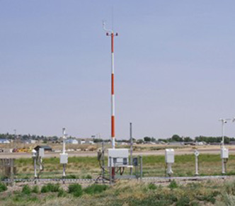
The airport AWOS system provides continuous, real-time information on local weather and simultaneously reports meteorological data to pilots, controllers, and airport operators.
AWOS helps pilots and aviation personnel make critical decisions by continuously providing real-time information and reports on airport weather conditions.
In addition to the meteorological sensors installed along the runways, the system also includes the central data processing unit and the data transmission system from the sensors. Data is displayed on the TWR Console and Meteorology Room via digital displays and indicators.
The AWOS system also produces the following reports in accordance with ICAO and WMO standards:
• METAR and SPECI
• SIGMET
• SYNOP
• AIRMET
• MET REPORT
• CLIMAT
Some of these reports are transmitted to aircraft in flight through the ATIS system.
- Meteorological sensors provide all the values required for data processing, namely:
- Wind Direction and Speed
- Temperature and Humidity
- Barometric Pressure
- Visibility
- Cloud Height
For viewing and radio transmission, the data is received at the Processing and Monitoring Center and, after processing by the corresponding software, forwarded to the monitors and indicators located in the Tower Console and Meteorology Room.

VHF-FM and UHF-FM radios
We sell the best radio brands: Tait, Motorola, Icom, and Hytera.
From analog to digital, conventional to trunking, portable and mobile terminals to systems equipment, the major radio brands mentioned above offer complete communication solutions for:
Government, Public Safety, Emergency Medical Services, and Fire Departments, Security Services, Ground and City Transportation, Large Industrial Companies, Companies operating in flammable locations, ground-to-ground operations at large and small airports, and general commerce.
Professional radio communication is aimed at achieving greater efficiency in organizational operations, task assignment, and critical missions.
To ensure greater effectiveness, we conduct coverage studies in both real-world scenarios and theoretical scenarios based on and developed with dedicated software.

FLIGHT-CHECK
For inspection and calibration services, we use equipment with an automatic DGPS tracker, providing a fully automatic and autonomous aerial inspection solution.
On all calibration flight missions, the equipment is thoroughly tested and verified to ensure its operation in accordance with applicable standard requirements.
During all calibration flight missions, the equipment is thoroughly tested and verified to ensure its operation in accordance with applicable standard requirements.
The inspection and calibration equipment operates independently of any other aircraft navigation or communication system, preventing any interference with onboard equipment.
This process ensures that the inspection flight results are accurate and traceable.
REPORTS AND NOTIFICATIONS
After completing the inspection flights, a comprehensive report is produced on the results obtained. However, if any parameter or tolerance does not fall within the permitted values, or if a more critical situation arises, the chief inspector immediately alerts the technical staff to the discrepancy.
Our inspectors actively collaborate with the technical staff to resolve any and all issues that arise during the inspection operations

HANDLING
Ground Handling Services, or Handling for short, is an English term that encompasses all services provided on the ground to support aircraft, passengers, baggage, cargo and mail.
Handling equipment, such as push-backs, passenger stairs, cargo-loaders, baggage x-ray.

